Choose Your Next R&M Adventure
Every photograph opens a real R&M story, collection, or original album.







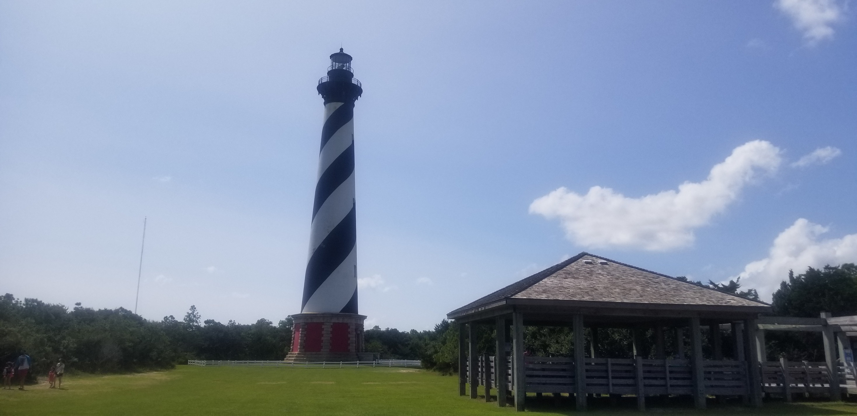
Outer Banks Road Trip
A four-day drive through barrier islands, ocean horizons, coastal villages, ferries, and the unmistakable spiral of Cape Hatteras Lighthouse.
A Ribbon of Road Between the Sound and the Atlantic
The Outer Banks turn a road trip into a journey through moving land. Highway 12 links villages, dunes, ferries, ocean, sound, and lighthouse stations across narrow barrier islands where every mile is shaped by weather and water.
The Road Is Part of the Destination
On the Outer Banks, the route never disappears into the background. North Carolina Highway 12 moves between ocean and sound, crossing bridges and narrow strips of sand where water may feel close on both sides. Each village is a stop, but the changing barrier-island landscape is the continuous story.
A Lighthouse Made to Be Recognized
Cape Hatteras Lighthouse rises above Buxton in a black-and-white spiral visible long before visitors reach its base. The present tower was completed in 1870 and received its famous daymark in 1873 so mariners could distinguish it from other coastal lights. It remains the tallest brick lighthouse in the United States.
The Graveyard of the Atlantic
Off Cape Hatteras, major ocean currents meet near Diamond Shoals. Shifting sandbars, storms, and powerful water made this coast dangerous to shipping and helped earn the surrounding waters the name Graveyard of the Atlantic. The lighthouse is beautiful, but its form begins with that serious purpose.
A Landmark That Had to Move
Barrier islands are always changing. By the twentieth century, erosion placed the lighthouse dangerously close to the ocean. In 1999, the tower and associated historic buildings were moved 2,900 feet inland, preserving the station while acknowledging the movement of the coast around it.
Why It Belongs in R&M Adventures
Ron and Michelle’s September 2020 album records a true road-trip story rather than a single stop. The lighthouse provides the hero image, but the memory comes from the entire route—sky, sand, villages, ferries, water, and the feeling of traveling along the edge of the Atlantic.
A Ribbon of Road Between the Sound and the Atlantic
The Outer Banks stretch along North Carolina’s Atlantic coast, with Cape Hatteras National Seashore protecting a long chain of beaches, barrier-island landscapes, and historic light stations.
Ready to plan your next adventure?
Tell Ron what you’re dreaming about, and Cruise Time Booker will help turn it into a clear vacation plan.
See the Complete Outer Banks Road Trip Album.
Continue through Ron and Michelle’s original photographs, or return to the main R&M Adventures collection.
Destination details were checked against official visitor information. Original photographs remain credited to R&M Adventures.
Back to Top